
Greater Cambridge Partnership has filed a 3.47km walking, cycling and horse route between the villages. It is a lawfulness certificate, not a planning bid.
Plans to link Oakington and Cottenham with a path for walkers, cyclists and horse riders reached the planning register on Thursday 3 September 2026. The Greater Cambridge Partnership wants to build a 3.47km multi-user route between the two villages, tying into the guided busway path at Westwick. (26/03358/CL2PD, Greater Cambridge planning register)
It is not a planning application. What has been filed is an application for a lawful development certificate under section 192 of the Town and Country Planning Act 1990.
That asks the council a legal question rather than a planning one: can this be built without planning permission? The council either agrees the works are lawful without permission or it does not. Whether the scheme is a good idea does not come into it.
The register reflects that:
- the consultation date is recorded as the same day the application was validated
- the item was not flagged as open for comments on the weekly list
- as of 6 September it holds no public comments and no consultee comments
What would be built
The route splits into two halves. (supporting statement by WSP for the Greater Cambridge Partnership, 7 August 2026)
- 805 metres of upgrades inside Oakington village, on Station Road between Mill Road and the busway junction at Westwick Terrace. This includes controlled crossing facilities at the guided busway junction, and footway and tactile paving improvements there.
- 2.47km of new shared path alongside Oakington Road, running between Oakington and Cottenham, mostly on farmland next to the road.
The new section would carry an equestrian canter strip alongside the shared path, so horses are not sharing the same surface as bikes. An existing bridleway, reference 168/10, runs through several stretches of the route and would be extended by about 100 metres westwards along Oakington Road.
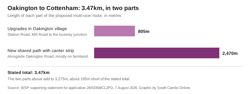
The two figures do not quite add up. 805 metres plus 2.47km comes to 3,275 metres, about 195 metres short of the 3.47km total the same paragraph gives. The statement does not explain the difference, and it describes the total as approximate.
The Greater Cambridge Partnership’s own website gives the Oakington to Cottenham link as 3.84km, longer again than the 3.47km in the application. Its figure covers the whole St Ives Greenway family of routes, which also includes about 20.8km along the busway itself, 1.3km for the Fen Drayton link and 0.92km for the Over spur. (St Ives Greenway FAQs, Greater Cambridge Partnership)
Why there is no objection stage
The application argues that most of the route needs no planning permission at all, for two separate reasons. (supporting statement, section 4)
- Work inside the boundary of an existing road, done by a highway authority to maintain or improve it, is not “development” under section 55(2)(b) of the Town and Country Planning Act 1990. The statement says bridleways and footpaths count as highway for this purpose.
- Work just outside but adjoining the highway boundary is permitted development under Part 9, Class A of the 2015 permitted development order.
Two stretches do not fit either category. Route sections 4 and 6, north of Monksilver Nursery and at the wooded verge south of Oakington Road, veer away from the road onto land that is not highway today. The plan there is to widen the highway boundary through a section 38 agreement, which has to be completed before work starts. The statement says filing this certificate application is what starts that process.
The determination deadline is Thursday 29 October 2026.
When it might actually be built
Not soon. The partnership’s project page records that its executive board agreed the full business case for the St Ives Greenway in July 2026. Detailed design for the Oakington and Cottenham spur is still being finalised while it works with landowners. The page dates that stage “TBC 2027”. (St Ives Greenway, Greater Cambridge Partnership)
The route is one of 12 Greater Cambridge Greenways. The others are named for Barton, Bottisham, Comberton, Fulbourn, Haslingfield, Horningsea, Linton, Melbourn, Sawston, St Ives, Swaffham and Waterbeach.
The FAQ page also says street lighting will be upgraded along the route and that signage and wayfinding will be installed on every greenway.
What it means for you
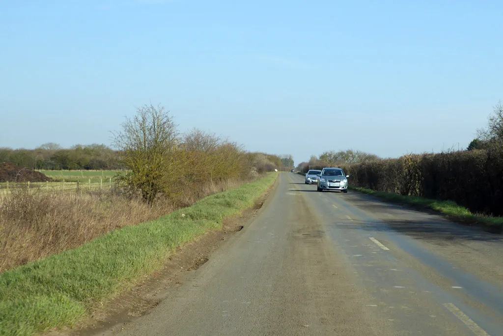
If you walk, cycle or ride between Oakington and Cottenham today, you do it on Oakington Road, which has no footway along the open stretch between the villages. That is what this scheme is meant to fix. It would also connect both villages to the busway path at Westwick, which runs into Cambridge in one direction and St Ives in the other.
If you have a view on the scheme, this application is a poor place to put it. There is no consultation period on it, and a certificate turns on whether the works are lawful, not on whether they are wanted. The scheme’s own engagement runs through the Greater Cambridge Partnership, which is still working with landowners on the detailed design, and through Cottenham and Oakington and Westwick parish councils.
Landowners along Oakington Road have a more direct interest. Sections 4 and 6 need land brought into the highway by agreement before anything is built there.
You can follow what else is on the register in the district on our South Cambridgeshire planning news page, and check current closures and diversions on South Cambs roadworks and travel.
Sources
- Application 26/03358/CL2PD, Greater Cambridge planning register (summary, dates and documents, including the WSP supporting statement of 7 August 2026 and the application form naming the Greater Cambridge Partnership as applicant)
- St Ives Greenway project page and FAQs, Greater Cambridge Partnership
Have your say